UAE's Best inaerial inspection Services
Ayn al Taqniya provides advanced data solutions for the UAE's AEC, Real Estate & Energy sectors. We specialize in precision Drone Surveying, 360° Inspections & BIM Modelling to reduce risk.

Drone Surveying & Aerial Mapping
Achieve sub-centimeter accuracy on your UAE project. Our GCAA-approved drone surveying & mapping services reduce costs, enhance safety & accelerate timelines. Request a consultation.
Learn more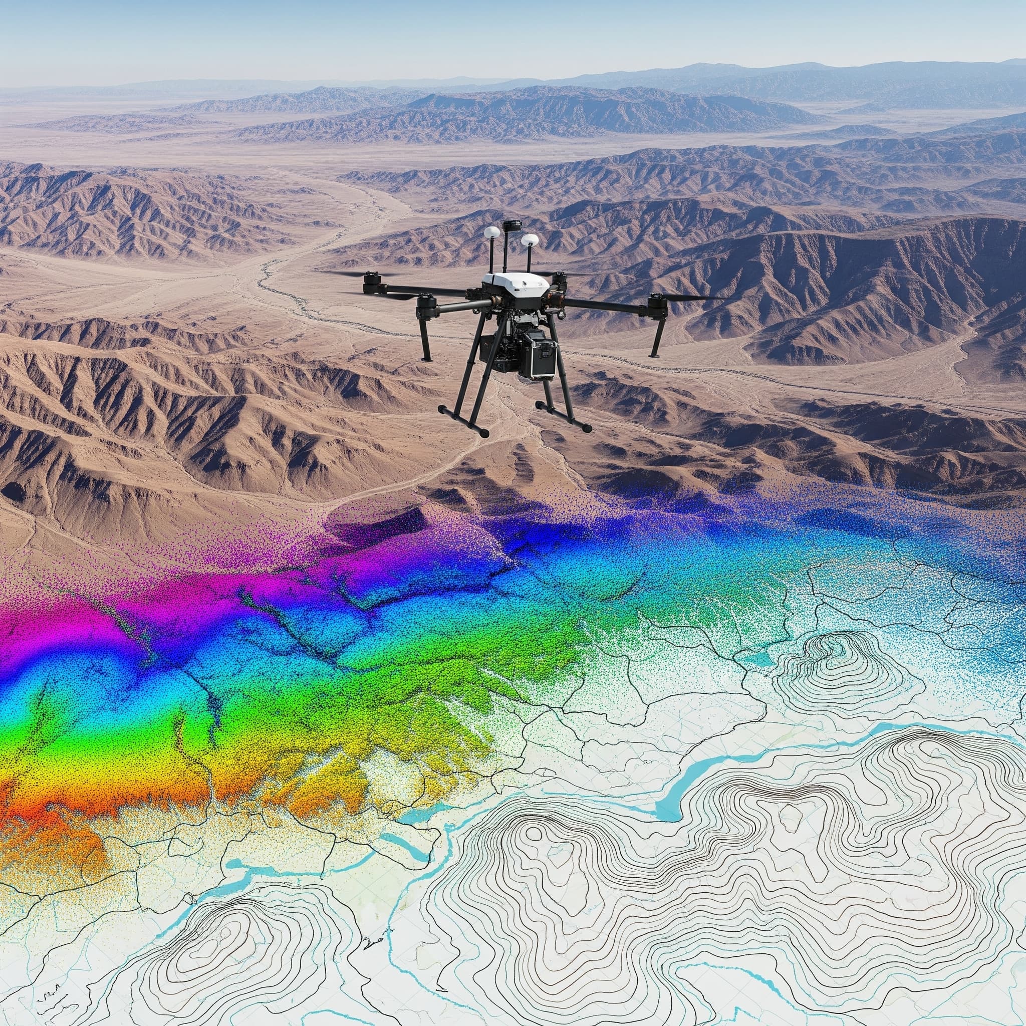
360 Site Inspections
Ayn al Taqniya provides immersive 360° photo data for virtual site inspections, progress monitoring, and digital handovers in the UAE. See your project from every angle.
Learn more
BIM Modelling & 3D Visualization
Ayn al Taqniya transforms drone & 360° data into intelligent BIM models. An add-on service for our data clients in the UAE, optimized for SIGNAX CDE integration.
Learn more